File:Serbia Montenegro.gif
From EGTRE

Size of this preview: 442 × 599 pixels. Other resolution: 1,044 × 1,414 pixels.
Original file (1,044 × 1,414 pixels, file size: 59 KB, MIME type: image/gif)
Summary
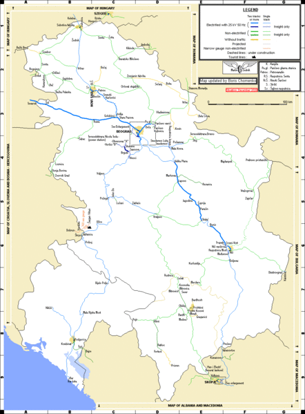
Railay map of Serbia and Montenegro drawn by Martin Zedník, updated by Boris Chomenko 23/12/2020.
File history
Click on a date/time to view the file as it appeared at that time.
| Date/Time | Thumbnail | Dimensions | User | Comment | |
|---|---|---|---|---|---|
| current | 08:07, 27 July 2024 | | 1,044 × 1,414 (59 KB) | Boris Chomenko (talk | contribs) | Railay map of Serbia and Montenegro drawn by Martin Zedník, updated by Boris Chomenko 23/12/2020. |
You cannot overwrite this file.
File usage
The following 3 pages use this file:
- Maps and Plans
- File:Serbia-Montenegro 2020-12-23.gif (file redirect)